Pierre Adolphe Capelle (1775 1851)
16°, original colour engraving, 144 pp. letterpress, pages with uneven margins, original brown wrappers (small folds in corners, little dusty, stamp 8. XI. 1946 in the lower margin of the last page, old tag with a title mounted n the inner side of the front wrapper, loss of paper to the spine, but overall a good used example in original publisher's wrappers). A theatrical piece on the French Revolution by French chansonnier, goguettier and writer Pierre Adolphe Capelle (1775 1851) .

VARIOUS AUTHORS. Johann STRANIMARYER, Author of the Collection.
8°, with 33 bound and sporadic loose Liedflugblätter (30 complete and 3 incomplete), bound with a string in a simple brown card wrappers, white endpapers with a hand-written annotation on the front loose endpaper (binding little rubbed and scuffed on edges, for condition report of each publication, see separate titles). PUB SONGS / FOLK MUSIC: [Songs. Gathered in This Year, when the Money was Very Low [lit. when the Tips were Poor]. For Entertainment of Everyone] - A unique collection of early 19th century Liedflugblätter, flying leaves with folk songs, mostly sung in pubs and on streets. - Liedflugblätter were flying leaves or tiny pamphlets with lyrics for popular songs, published in German speaking territories from the 16th century on. They were usually printed by local publishers and sold for small amounts of money mostly for entertaining purposes. The motifs of songs, which were mostly sang in pubs and on streets (Gassenhauer), rotate around drinking, love, women, food and sometimes around politics. Instead of musical charts, which not many people were able to read, the flying leaves quote other popular tunes, usually from famous operettas or popular musical theatres, which the printed song should be sung to. Due to their ephemeral nature Liedflugblätter are exceedingly rare and are often known through single examples, preserved in institutions. The present charming collection of 33 flying leaves, dated mostly in the time of post-Napoleonic era and until the mid-19th century, was printed in the territory of today's Austria and Czech Republic and was collected by one Johann Stranimaryer from Kapfenberg, in Styria (Austria). Some publications from the collection appear not to be preserved in any institutions. PLEASE CHECK OUR WEB PAGE FOR A LONGER DESCRIPTION AND THE LIST OF THE PAMPHLETS
Johann Christian NOSSEK (1804-1856).
12°, XV, 88 pp., folding plate, original yellow wrappers with lettering (minor sporadic light staining, old annotation in black ink on first blank page and in the upper margin of p. 1., soft folds in corners, otherwise in a good condition with minor shelf wear) An exceedingly rare pioneering work on English pronunciation, published in the Austrian Empire. - Johann Christian Nossek (1804-1856) was the first notable Austrian linguist, who introduced English pronunciations and spellings to his fatherland, following contemporary German examples. He studied classical languages and soon developed interest in English, as an important international modern language. Mostly during the late 1830s he authored works on learning English and was later active as a teacher, translator and author of magazine articles. The present book, listing correct pronunciation of personal and geographical names in English is one of the first Nossek's recorded separately published works and probably one of the first books on learning English pronunciation, issued in Austrian Empire. A contemporary advertisement describes, that the book excels though its "clarity, elegance and clearness" (Allgemeine Zeitung München, 1836, p. 1750). In the same year, Nossek also published Englisches Lesebuch, Auswahl in Prosa und Versen (English Textbook, a Selection of Prose and Verses) and worked as an editor on the second edition of Kunst in zwei Monaten ohne Lehrer Englisch lesen, verstehen, schreiben u. sprechen zu lernen (The Art of Reading, Understanding, Writing and Speaking English in Two Months without a Teacher) by Julius Stephan Zerffi. Although the title pages quote, that the book was published in Graz, as well as in London and Leipzig, it was probably printed in very small numbers and it was not commercially successful. We could not trace any institutional examples. Worldcat lists the title with no recorded copies in libraries (OCLC 257686392) and the Austrian National Library does not hold an example. References: Cf.: Biographisches Lexikon des Kaiserthums Oesterreich, on-line source: BLKÖ:Nossek, Johann Christian Wikisource.
Raymond JANIN (1882 1972).
8°, 72 pp., index, [4 pp.] with 4 photolithographed plates, blank, original paper wrappers with lettering (good, clean condition) A seminal work on the history of Thrace, Greece, published in Istanbul on the eve of the Greek War of Independence. - Raymond Janin (1882 12 July 1972) was a French Byzantinist and a monk, who authored several work on the history, art history and geography, connected with the Ottoman Empire. On the eve of the Greek independence he published this text on the history of Thrace, at the time still a part of the Ottoman Empire, and exposed a problem of the multicultural area, inhabited for centuries by Greeks, Turks and Bulgarians, as well as Jews, Albanians etc. This is an uncommon separately published edition. The text was also issued in magazines Échos d'Orient (OCLC 5704902223). In 1921 Janin published a sequel La Thrace byzantine. Woldcat liste examples in the following institutions: BNUS Bibliotheque Nationale Universitaire de Strasbourg, Biblioteca Central? Universitar? "Lucian Blaga", Cluj-Napoca, România, Radboud University, Aristotle University of Thessaloniki, Bibliothèque nationale de France, Institut francais d'études byzantines, University of Massachusetts Amherst, Princeton University Library, Dumbarton Oaks Research Library and National Diet Library. References: OCLC 15733769.
12°, 159 pp. with black and white illustrations and folding plates, 3 colour folding plates, [4 pp.], original wrappers with lettering (used condition, wrappers with foxing and small tears and holes, tiny tears in margins, old sollector's stamp and annotations on th etitle page). A German WWII army manual, describing uniforms, weapons, planes, tanks etc. of the British Army in Europe and Africa.
CUERPO DE ESTADO MAYOR DEL EJÉRCITO.
Colour photolithograph, on 6 untrimmed and un-joined sheets of thick paper, housed in decorative printed paper sleave bearing blindstamp of the 'Depósito de la Guerra', rolling into original crimson tube bearing title in silver lettering (Very Good, clean and bright with lovely colours, just a small hole to outer blank margins and light creasing to extremities of map sheets, sleave with a few minor marginal repairs, tube worn with some surface loss to one end), each map sheet: 60 x 79.5 cm (23.5 x 31.5 inches), if sheets trimmed and joined would form a map measuring approximately: 100 x 205 cm (39.5 x 80.5 inches) MOROCCO (SPANISH / NORTHERN) / RIF WAR: An extraordinarily beautiful and monumental production (over 2 metres wide!), being an official map of Spanish Morocco (comprising the far north of the country), produced by the General Staff of the Spanish Army to celebrate their 'triumph' in the recent Rif War (1921-6), during which Franco-Spanish forces (with great difficulty) suppressed a Berber mass insurgency; surmounted by a grand cartouche with the Spanish royal arms, with resplendent colouring and a wealth of detail, the map is predicated upon the best and most recent scientific surveys, making it both decorative and practically useful a stellar example with the original crimson, silver-lettered tube in which it was issued. - This is almost certainly the most beautiful and impressive map ever made of Spanish Morocco. It was created in December 1927 by the Cuerpo de Estado Mayor del Ejército (General Staff of the Spanish Army) and printed in Madrid by the Talleres del Depósito de la Guerra, the army's publishing division. The giant 6 sheet map (that if joined would measure approximately 100 x 205 cm) is surmounted by flamboyant cartouche featuring the Spanish royal arms and is executed to an ample scale of 1:200,000. The photolithography employed is of the top quality and the colours are resplendent, while the topography is predicated upon the best and most recent scientific surveys. Thus, the map, being both decorative and practically useful, was clearly intended to be a graphic manifestation of Spain's 'triumph' in the Rif War. The map features a vast wealth of detail, as explained in the 'Signos', in upper left corner of Sheet 3, featuring the symbols used to identify European towns; Moroccan villages; souks; mosques; isolated houses; military positions or European camps; aerodromes; lighthouses; anchorages; Moroccan tent encampments; roads; highways; railways; bridges; the Line of the 1912 Treaty; district boundaries; contour lines (at 50 metre intervals); rivers; arroyos; lagoons, swamps, canals; springs; wells; and 'Officinas de Intervención' (Spanish colonial offices). The chart of 'Abreviaturas' below explains the shorthand used to describe topographical terms. PLEASE SEE OUR WEB PAGE FOR A LONGER DESCRIPTION
José C. de CARVALHO, Cartographer. / ORGANIZZATA DALLA SOCIETÀ PROMOTRICE D'IMMIGRAZIONE DI S. PAOLO, Sponsor.
Colour lithograph, mounted upon modern linen, with register on verso preserving the view of the contemporary handstamp of a 'Pietro Milanese', a Genoa immigration agent (Very Good, overall clean and bright with lovely colours, just some minor print transference and very minor stains, very slight wear along former folds), 42 x 62.5 cm (16.5 x 24.5 inches) BRAZIL SAO PAULO STATE / ITALIAN IMMIGRATION TO BRAZIL: An exceedingly rare, early and highly attractive map of Brazil's Sao Paulo State, with text in Italian, showcasing the booming region to Italian immigrants (almost a million Italians arrived in Sao Paulo between 1880 and 1920), drafted by the military engineer José C. de Carvalho and published in Rio de Janeiro at the behest of the 'Società Promotrice d'Immigrazione di S. Paolo', the map depicts all of the region's major infrastructure and identifies the locations of urban areas of Italian settlement and rural Italian 'colônias', while a diagram in the corner expresses the region's topography in clever and engaging way. - The present map showcases Sao Paulo Province, the main destination for Italian immigration to Brazil. With text entirely in Italian, it was published at the behest of the recruitment organization, the Società Promotrice d'Immigrazione di S. Paolo, having been drafted by the military engineer José C. de Carvalho and published in Rio de Janeiro by the firm of Paulo Robin. Issued in 1886, it is very early for any Brazilian immigration map, made only a decade after the first wave of Italians arrived in the country; all the others such maps we have encountered date from after 1900. Beautifully designed, and employing resplendent colours, the map shows Sao Paulo to be a dynamic, rapidly growing place, perfect for Italians looking to start a new life of action and opportunity. The main map shows all key topographic features; labels all cities and major towns; delineates all major railways and navigable rivers; while shipping lines are shown to run out of the province's main port, Santos (including those providing connections to Italy). The registers of text below the title list all Sao Paulo's railways (both in operational and under construction), with their length in km, along with the major river steamer routes. The heavily developed bulk of Sao Paulo province is shaded in beige, while the sparsely populated northwest, the 'Terreni Spopolati' (Depopulated Lands), is shaded in green. Importantly, places with major concentrations of Italian immigrants, called 'Nucleo coloniale', are noted in green, including both urban areas and rural colônias de imigrantes. In the lower left corner is a striking and clever diagram, 'Distanze in Kilometri dal Porto di Santos', which shows, in deliberately exaggerated terms, the topography of Sao Paulo Province; the area's major cities and towns; the 'Nucleo coloniale'; and the locations of key mineral deposits (ex. 'Minas de Ferro' and 'Minas de Petroleo'). The register on the left side shows the elevation of marked places on the diagram; while that on the right notes the average annual temperature (which decreases as elevation increases); while the register on the top shows the distance of each place from the port of Santos, the gateway to the province. For instance, Sao Paulo city is shown to be 80 km from Santos, at an elevation of 760 metres, with annual average temperature of 19 degrees Celsius. The inset in the upper left corner, 'Posizione del Brasile nell'America del Sud', shows Brazil's location within the greater context of South America. Interestingly, the present example of the map features the contemporary handstamp on the verso of a Genoa immigration recruiter. It reads: 'Per l'Imbarco de famiglie chiamato dovranno dirigersi esclusivamente a Sig. Milanese Pietro / Via Ponte Calvi 4 e 6 / Genova' [For boarding of families called they must go exclusively to Mr. Pietro Milanese / Via Ponte Calvi 4 and 6 / Genoa]. The map was drafted by the military engineer, Commander José C. de Carvalho (his name is signed in print, lower right), who in 1887 was recorded as being one of the directors of the prestigious Clube de Engenharia of Rio de Janeiro. Carvalho was heavily involved in the railway construction boom and the high-profile 1888 effort to transport the Bendegó Meteorite (which weighed 5,360 kg) from Bahia Province to the National Museum in Rio de Janeiro. Carvalho was especially commissioned by Italian immigration organizations to make the present map of Sao Paulo, as well another similarly themed map of Rio de Janeiro Province, the Mappa della Provincia di Rio Janeiro fatto organizzare dal Presidente della Provincia Antonio da Rocha Fernandes Leao pel servizio dell'Immigrazione 1887 (Lith. e Typo. H. Lombaerts & Ca, Rio de Janeiro, 1887), please see a link to this map. PLEASE SEE OUR WEB PAGE FOR A LONGER DESCRIPTION
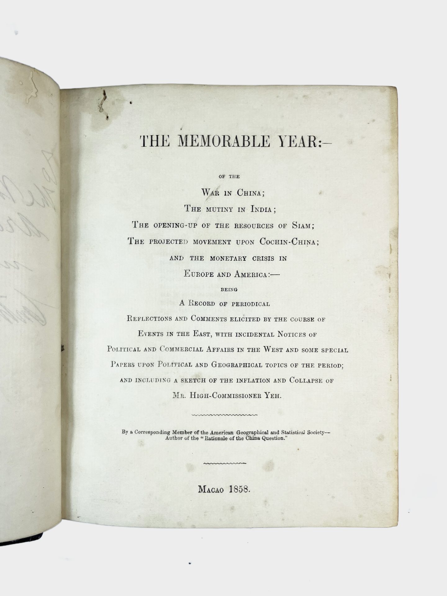
Gideon NYE (1812-1888).
Large 8°, [24 pp.] with title, verses, preface, index, 4 blank pages, starting with p. 9 on second text page (complete), 360 pp., pp. A-D between pp. 339-340, contemporary half dark brown calf with gold tooling and lettering on the spine and marbled paper boards, a presentation copy with a dedication by the author in black ink on the first blank page and a later owner's signature in pencil in the upper part "A. Salles, Paris, Oct. 1903" (pp. 318-319 with a tear in the upper white margin, small worm holes in the inner upper corner of the first part, minor sporadic staining, binding slightly rubbed on the corners and in the upper and lower part of the spine, but overall in a good condition) MACAO IMPRINT: A rare book on the events in China, Cochin China, and India, authored by an American diplomat Gideon Nye in Macao, in 1858, and written in a modern style, where the author seeks connections between global events and is not discussing them in isolation. With a dedication by the author to John Gray, the Archdeacon of Hong Kong - Gideon Nye (1812-1888) was an American diplomat, writer and art collector, who arrived to China in 1831 from his native Massachusetts. He lived in Guangzhou and Macao until his death in 1888 and in almost six decades in China, Nye, a corresponding member of the American Geographical Society and an American Vice Consul, authored several books on the region, political events, such as the events which leading up to the First and Second Opium Wars, tea trade and art. A contemporary report describes Gideon Nye as "Nestor of foreign residents in China, publicist, philanthropist and patriot." Chinese Recorder and Missionary Journal, Vol. 19, 1888, p. 525). In this book, printed in Macao in 1858 and addressed to American readers, Nye describes a series of contemporary events, related to China, Cochin China, and India and connects them into a group of global events. The book is dedicated in manuscript on the first blank page by the author to John Gray (1823 1890), the Archdeacon of Hong Kong (1868-1878), and a consular chaplain at Canton (Guangzhou, 186778) and a commissary of the Diocese of Victoria, Hong Kong: To the Venerate Archdeacon Gray with Mr. Nye's Compl[iment]s. Canton 12th March 1870. We could trace about half a dozen institutional examples on Worldcat, the other appear to be microfilms (Harvard Law School Library, Phillips Library (Peabody Essex Museum), University of Wisconsin Milwaukee, The Claremont Colleges, Library of Congress, American Antiquarian Society, The British Library (or microfilm?), Yale University Library (or microfilm?)). References: OCLC 681653924 (also microfilm), 504088286.