SNOW, Edward Rowe
Boston, Massachusetts, 1941
Boston, Massachusetts: The Yankee Publishing Company, 1941. Wraps. Very good. Edith STEVENS. [MAP]. SNOW, Edward Rowe, Aerial and Island Survey. U.S. Coast and Geological Survey, Chart 246. The Islands of Boston Harbor, 1935. Drawing by Whitman and Howard, Engineers, Edith STEVENS, illustrator.
8vo; 57pp [1]; photographic illustrated wrap with cloth spine; illustrated with black and white photographs; one tipped in fold out map printed in green ink, crease to right side, light age toning of paper; lacking map tipped inside front cover; scuffing to front cover with loss to illustration, light soiling wrapper; very good.

LOCKE, J.S.
Boston, 1879
Boston: Graves, Locke & Co., Publishers, 1879. Wraps. Very good. [TRAVEL] [SOUVENIR] [EPHEMERA]. Boston Stereotype Foundry, No. 10 Spring Lane, printers.
Cover title: Old Orchard Maine
Map: Plan of Ferry Beach Park, Cottage Lots, Ferry Beach, Saco, Maine, 2 pp
Fold-out illustrated bird's-eye-view map with vignettes: Balloon View of Old Orchard, Me., along with On the Beach at Low Tide, and 11 vignettes of guest houses and one of the Rustic Observatory at Ferry Beach Park.
12mo; 48pp; 2 staple binding; pale green stiff wrapper printed with two vignettes of homesteads and title; 4 wood-cuts of guest houses; age-toning of paper; fold-out map has 2 small tears through the neat line with loss, and one short separation at fold intersections; very good minus. The preface starts with the statement, ‘When an individual becomes distinguished, there is a demand for his biography; and when a locality springs into notoriety, there is a demand for its history.' A promotional pamphlet for a popular 19th-century vacation area on the coast of Maine. Included are wood-cuts of the Falmouth Hotel, Biddeford House, Saco House all in Maine, and the Tremont House, Boston.
BROCKWAY, Charles J.
Newburyport [Massachusetts], 1875
Newburyport [Massachusetts]: William H. Huse & Co., Printers, 1875. Wraps. Very good. [GEOLOGY] [MAP].
Map: Map of Mining Lands at Newbury and Newburyport, Essex County, Massachusetts, Boston: The Hatch Litho Co., 1875.
12mo; 60pp; map attached to title page; lacks a wrapper, publisher's stab-stitched leaves; light soiling to title and last leaf; 2 spots on pp37; very good. Located in 10 OCLC libraries.
Map: Paper size: 19 ¼" x 22 5/8"; 17 ¾" x 22 3/8" within the neat line; closed tear to left side extending through the neat line at attachment to page; very good. Detailed report on the silver and lead mines of eastern Massachusetts around Newbury and Newburyport. The attached map supplements the report giving an interesting and detailed look at these communities in 1875. Included are the land plats with ownership, points of interest including train depots, ice houses, farms, factories, churches, mills, schools, cemeteries, a mining station, meeting houses, a hotel, brickyard, the town green and two lighthouses. Two railroad lines are shown: the Boston and Maine line and the Eastern Rail Road line. There are interesting geographical areas identified, including: Devil's Den, Hump Sands, Newbury Flats and Salisbury Beach; several islands: Carrs Island, Seal Island and Woodbridge Island; and 10 creeks and rivers.
ABERT, Lt. Col., J.J., Topographical Engineer
[Washington, D.C.], 1838
[Washington, D.C.]: 25th Congress, 2d Session [Senate], 1838. Wraps. Very good. [MAP] [GOVERNMENTAL REPORT] Blair & Rivers printers.
Fold-out map: Owl's Head Harbor Maine, Aug. 1836, by Lt. Col. S.H. Long, Lieuts. J.F. Cooper, and J.I Donaldson. 16 ½" x 13"; one 1 ½" closed tear to left side where map is bound in.
Fold-out map: Chart of Owlshead Harbour and Projections of a Breakwater, Drawn by Y.A. Barton and A.R. Flint,1837. 16 ¼" x 12 ½"; one 1 ½" closed tear to left side where map is bound in; creasing; moderate amount of foxing.
Fold-out map: Cobscook Bay Maine, surveyed 1836, by Lt. Col. S.H. Long, Lieuts. J.F. Cooper, and J.I. Donaldson. 16 7/8" x 13 1.4"; one 1 ½" closed tear to left side where map is bound in.
8vo; 13pp; 3 bound in maps; stiff tan wrapper, title written in ink; three staple binding; ink on front wrapper shows splatter damage, light foxing throughout; very good with 2 near fine maps. OCLC locates this in 5 libraries. The safety of navigation up and down the east coast of Maine and the U.S. was a constant priority for the War Department and commercial shippers. Surveying by the Topographical Bureau located safe harbors and made recommended improvements on those that could be made safe. Protection during storms was paramount for the Naval fleet and commercial shipping. This survey looks at Owl's Head Harbor, a small harbor in mid-coast Maine, and Cobscook Bay located far north at the Maine and New Brunswick, Canada border.
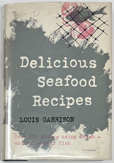
GARRISON, Louis
New York, 1953
New York: Thomas Y. Crowell Company, 1953. Cloth. Near fine/near fine. Dust jacket title: Delicious Seafood Recipes, Over 250 dishes using fresh—and salt-water fish.
8vo; xi, [iii], 204+ [6]pp blank Notes; turquoise cloth over board, white stamped lettering on spine; ownership on ffep dated "1953"; small srubs to bottom edge; unclipped color pictorial dust jacket signed "P. & J. Chollick," light sunning to dj spine, and a spot on rear panel, small closed tear on bottom front edge; near fine in nf dj. A clean and bright copy of this wonderful seafood recipe book. The preface is written by Frank W. Wilkisson, President of The Fishery Council, a group dedicated to promoting fish in the diet. The endorsement states, "...we are pleased to see this book make its appearance. It embodies much of what we believe and it must be regarded as a major contribution to the art of cooking—and enjoying—fish. It should prove mutually beneficial to the consumer and to the fishing industry.".
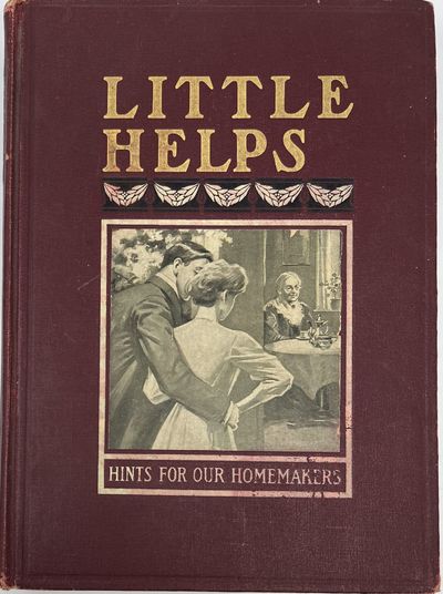
NATIONAL MAGAZINE
Boston, 1909
Boston: The Chapple Publishing Company, Ltd, 1909. Cloth. Very good. [HOME ARTS] [COOKERY] [CLEANING]. Cover title: Little Helps, Hints for Our Homemakers
8vo; 341pp + 10pp Index; maroon cloth over board, gilt-stamped lettering on front and spine, b&w pictorial onlay of a young man and woman looking at an old woman at a table; rubbing to boards, loss at corners, light foxing throughout; very good minus. An interesting collection of household helps including cooking tips, short recipes, hints on cleaning and washing, sewing tips, useful health remedies, and exterminating advice. The blurbs are each titled but collected in no specific order, making for interesting reading but problematic if one is looking for only one topic. The useful 10-page index at the rear of the text is divided into subject matter. Perhaps the most interesting is the section is titled Pyrotechnic Department with information on making Bengal Lights, Crimson Fires, Japanese Parlor Fireworks, and Rockets!
Praze [Prague]: Nakladatelství Jos. R. Vilímek, 1930. Boards. Very good. Artuš SCHEINER. [JUVENILE] [WOMAN AUTHOR] [CZECH LANGUAGE]. Artuš SCHEINER, illustrator.
English: Aquarius Ivan, Prague: Jos. R. Vilimek, Publisher
4to, 76, [1] pp; color pictorial front board depicting a dancing boy waving an American flag, watched by a man and woman sitting on a couch; red cloth shelf-back; blue and cream pictorial endpapers; title page in red and black ink, vignette of Ivanek in red; thick paper stock; tinted head and tail pieces; fp + 7 color plates tipped in; light edge wear to boards, age-toned paper and foxing throughout; very good. OCLC locates only 2 copies, one at Princeton University and the other at the National Library of the Czech Republic. This book is based loosely on the Czech legend of Vodník, the underwater creature living in the Vlatava River running through the city of Prague. In this tale, an underwater family, with a boy named Ivánek, lives under the Vyšehrad rock. Ivánek has adventures and misadventures with a human friend named Vinck, including a kidnapping to the United States. The first page illustration features a charming family scene at the top of the page picturing the cathedral of Sts. Peter and Paul in the Vyšehrad, an historic area of a former fort and castle overlooking the river.
A strong Art Deco influence in the art of Artuš Scheiner (1863-1938) can be seen on the front board. Scheiner was a painter, illustrator, and puppet maker living in Prague and known for his work in watercolor (gouache).
Portland, Maine: L.H. Nelson Company, Proprietors of Nelson's International Series of Souvenir Books, 1906. Wraps. Very good. [VIEWBOOK] [SOUVENIR] [STATE OF MAINE] [EPHEMERA].
Cover title: Old Orchard and Vicinity
Second edition. 8vo oblong; [32]pp; gilt-embossed title and vignette to stiff purple wrapper; 2 staple binding; 31 b&w half-tone photographic illustrations with titles; sunning to front with discoloration, light shelf-wear to wrapper, staples rusted but holding; very good minus. Souvenir style booklet with views of hotels, piers, street scenes, trolley tracks, beaches with people walking and bathers, Seaside Park, public buildings and churches, the camp ground and Tabernacle at the camp ground, inland parks, Prout's Neck, and Wood Island Light. The beach scenes with crowds of vacationers and bathers are very interesting.